TRAILS AND ITINERARIES TO GET TO KNOW THE MUNICIPALITY OF FAEDIS
In this section you will find some suggestions of trails and itineraries that you can follow to discover and experience the Faedese territory to the fullest (Pictured is the Pian delle Farcadizze, above Canebola).
However, it is advisable to buy a map where all the trails are accurately marked (sheet No. 26 – Prealpi Giulie Valli del Torre – Casa Editrice Tabacco) or use the map above (OpenStreetMap) on which the main trails in the Municipality of Faedis are already marked. The walks we propose are accessible to everyone, are not particularly difficult and give the opportunity to admire beautiful landscapes: from the highest points, on clear days the view reaches all the way to the sea.
Thanks to funds made available by the European Community under Objective 5B, the municipality has fixed up the paths in the area with tables, bridges, walkways, etc. On each of the following pages you will find specific descriptions of the trails presented, ranging from beautiful walks through the woods and meadows of the municipality, to a tour among the most striking places of Faedo’s artistic heritage.
THE TOUR OF THE MUNICIPALITY OF FAEDIS
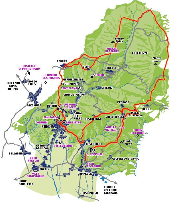
This is the route of the traditional Town Hall Tour that is held every year on one of the Sundays in March. It starts from the square of Faedis, m 170 a.s.l., to the small church of San Rocco or to i Castelli, subsequently taking the path to Porzûs, m 683 a.s.l.. Shortly after the village you can choose to pass through Clap, m 684 a.s.l., and then rejoin on Mt. Carnizza, m 981 a.s.l., or continue to follow the trail until reaching Mt.
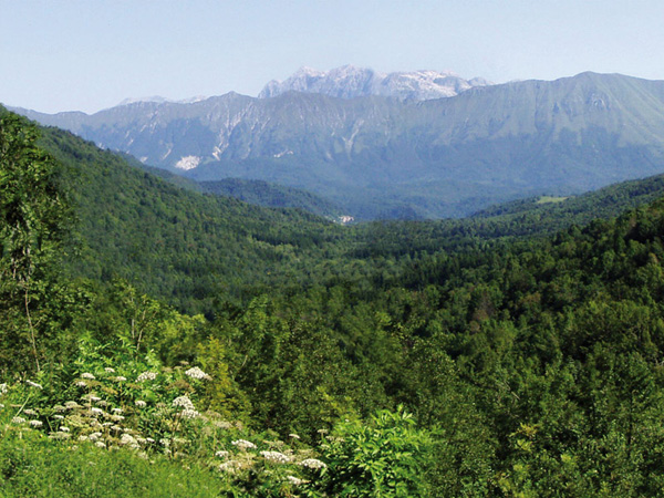
Continuing on, we pass Mount Iauar, m 1005, and then arrive at the “famous” malghe di Porzûs, m 968 a.s.l., the scene of the tragic event that occurred in February 1945. After the malghe we continue to Monte Spich, m 924 a.s.l., and then descend and arrive at the forest road that will take us to Farcadizze (Farcadizze is one of the most beautiful areas of the municipality: it is a valley, located just above Canebola accessed through Bocchetta di Sant’Antonio), where we will continue to the state border near which we will take the Italia trail (No. 744) for a stretch.
After leaving the Italia trail, we will continue along a series of paths that, skirting the summit of Mount Joanaz, m 1167 a.s.l., will take us to the refuge of the same name, m 949 a.s.l., below Mount Caludranza, m 974 a.s.l. After passing the refuge, we will continue to Mt. San Lorenzo, m 913 a.s.l., just above Valle, from here you can choose whether to continue to Valle, m 678 a.s.l., or by Pedrosa, m 754 a.s.l.. Whatever choice is made, it will then be necessary to take the communal road that leads to Costalunga, m 593 a.s.l.. From here you will take the path leading to Monte Forchiai, m 482 a.s.l., and then descend to Raschiacco, m 179 a.s.l., and then walk to Faedis, following Via Cuarde.
This route gives the opportunity to fully admire the views offered by the mountains of Faedis, particularly striking from Valle, Costalunga and Canebola. The equipment needed to tackle this route is very simple: a pair of boots or hiking shoes is sufficient, and in case of bad weather it is advisable to bring a windbreaker or a K-way, depending on the season. The duration of the hike ranges from 9 to 12 hours.
HISTORICAL TRAILS IN THE MUNICIPALITY OF FAEDIS
The trails presented here were cleaned up and fixed thanks to grants from the European Community Objective 5B. These trails are also included in the information boards placed in Piazza I maggio in Faedis and at the beginning of each trail. Each trail has been meticulously marked with precise tables and directions.
1st Route – Castles of Zucco and Cucagna
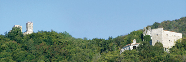
It starts from Borgo S. Anastasia, m 181 a.s.l.. This hamlet, located just below the manors, originated at the time of castle construction when servants’ dwellings and stables were located here; its name comes from an ancient church that has now disappeared. Our walk begins by setting out on the path that since the Middle Ages has been the only access road to the Castelli di Zucco e Cucagna. After about 15 to 20 minutes of walking we arrive at the Zucco castle, m 299 a.s.l., where we can admire the small 16th-century church as well as a splendid panorama. Continuing through the path, after about ten minutes we arrive at the Cucagna Castle , m 357 a.s.l., whose reconstruction is well under way, particularly impressive and the imposing tower fully restored.
Passing Cucagna Castle after a few minutes you come to a trail junction where you can: continue the walk by going up to Porzûs; go down to Poiana; continue toward Faedis.
Descending towards Poiana it is possible to continue the walk through the woods until you reach the Partistagno Castle Above Borgo Faris in the municipality of Attimis. Toward the end of the 1200s the Castle of Partistagno, along with its possessions passed to the Cucagna family by order of the Patriarch of Aquileia, by extension of the lineage.
Continuing toward Faedis instead we will continue on the path that leads to the church of San Rocco.
(In restoration work on the small church, a cycle of frescoes on St. George dated between 1300 and 1400 by the school of Vitale da Bologna emerged.)
Along the trail we pass by the remains of a building, which probably served as a control tower at the time of the Castles.
The tour takes approximately 1 hour 20 minutes and does not require any special clothing, just be sporty and comfortable.
2nd Route – Canal di Grivò, Baita Topli Uorch (Malghe di Porzûs)
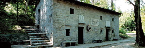
The walk begins at Canal di Grivò , m 228 a.s.l., where we will take the path to Gradischiutta, m 364 a.s.l.. After this stage we will continue to the little church of St. Magdalene 14th century, probably built on the ruins of an ancient fort. The next stage is Clap, m 684 a.s.l.; from here we will continue on the path leading to Mt. Iauar, m 1005 a.s.l. After this we will head to the huts of Porzûs, the scene of the tragic event in February 1945.
At Clap you may also decide to lengthen the route by at least an hour, proceeding to Porzùs.
The walk takes about 2 hours and 40 minutes; to tackle it more comfortably, it would be best to wear a pair of hiking shoes or if you prefer hiking boots. When you arrive at the Malghe, you can also decide to continue to the Bocchetta di Sant’Antonio by taking the path whose entrance is on the road leading to the Malghe.
3rd Route – Stremiz, Canebola, Mont Joanaz
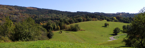
This is one of the oldest trails, much used in the past. It starts from Stremiz, m 315 a.s.l., setting out on the path that leads to Canebola, m 669 a.s.l. From Canebola we continue towards the Bocchetta di Sant’Antonio, m 788 a.s.l., through which you access the Farcadizze, a valley of special naturalistic value. After the Bocchetta di Sant’Antonio we continue to Mount Joanaz, 1167 m above sea level.
The walk takes about 2 hours and 20 minutes, and to tackle it more comfortably it would be best to wear a pair of hiking shoes or if you prefer hiking boots.
4th Route – Canebola, Pedrosa, Valle, Mont Joanaz
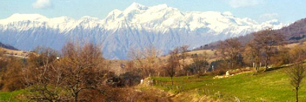
This itinerary gives the best way to savor the scenery that can be seen from the Faedo mountains. The walk begins at Canebola taking the path to Pedrosa, arrived in Pedrosa, you can continue either to Valle lengthening the walk a bit or towards the Mount San Lorenzo. The next destination will be the Mount Joànaz, 1167 meters above sea level. The duration of the walk is about 3 hours. Appropriate clothing and shoes.
5th Route – Canal del Ferro, Costalunga, Raschiacco
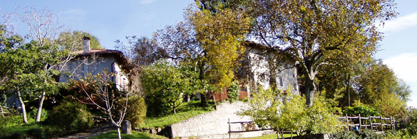
The walk begins at Canal del Ferro, a hamlet above Faedis, which is reached via the road leading to Canal di Grivò. The ancient mule track to Costalunga can be taken at Canal del Ferro di sopra, m 204 a.s.l., or at Canal del Ferro di sotto, m 188 a.s.l. From wherever we start, the path will lead us directly to Costalunga, m 593 a.s.l.. From here we will continue on to Mount Forchiai, m 482 above sea level. Along this path, halfway between Costalunga and Mount Forchiai, you may choose to descend by the forest road, which is a few meters below, arriving at Ponca, a waterhole on the Grivò stream. Continuing along the trail instead will take you to Raschiacco, m 179 above sea level.
The walk takes about 1 hour and 30 minutes, and to tackle it more comfortably it would be best to wear a pair of hiking shoes or if you prefer hiking boots.
6th Route – Ring “In the Ban”
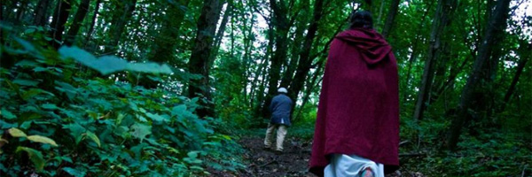
Thanks to the work of the Pro Loco of Soffumbergo (soffumbergo@yahoo.it), the inhabitants and former inhabitants of Colloredo di Soffumbergo and Valle, and thanks to the support provided by the Comunità Montana Torre Natisone Collio and the Banca Popolare di Cividale, it has been possible to recover and make usable, an important piece of the woods that dress the hills of the Municipality of Faedis.
“Nel ban” is a restored network of trails in the area between Colloredo and Valle, between the Municipality of Faedis and Torreano, where visitors can find contact with nature immersed in the silence and tranquility of the forest.
The level of difficulty varies between the Tourist and Hiking level of the Scale drawn up by CAI. It is well marked, in addition to the conventional signage there are an additional 18 tables. The elevation difference is 405 meters.
Light but tall boots and water bottle are recommended. The various suggested routes have an average duration of about an hour and a half. The trails are passable year-round, remembering that hunting is practiced in the fall months and that the trails cross private property.
ITINERARIES IN THE NATURE OF THE MUNICIPALITY OF FAEDIS
The tour optionally starts from the path to the little church of San Rocco or from the one leading to the Castles. Both alternatives then join in the path to Porzûs, m 683 a.s.l.. Shortly after passing Porzûs, two possibilities present themselves. The first is to take a tour of the Farcadizze (the Plan of the Farcadizze is a large basin located just above Canebola that is accessed via the Bocchetta di Sant’Antonio. This valley, which is crossed by the Rieca stream, offers a truly picturesque landscape and natural environment), and then continue to Valle. The second option, on the other hand, is to head to Valle via Clap and Canebola.
The first alternative takes us to continue to Mt. Carnizza, 981 m a.s.l., past which we hike to Mt. Iauar, 1005 m a.s.l., and then continue to the “famous” huts of Porzûs, the scene of the tragic event in February 1945. After the huts we will head to Mount Spich, m 924 a.s.l., and then descend and arrive at the forest road that will take us into the Farcadizze. Crossing the valley we will arrive at Bocchetta di Sant’ Antonio, m 788 a.s.l. From here we will descend to Canebola to take the path to Valle.
The second alternative, on the other hand, calls for the walk to continue for Clap, m 684 a.s.l., and then continue on the municipal road leading to Canebola, m 669 s.l.m., from where we will take the path to Pedrosa andValle.
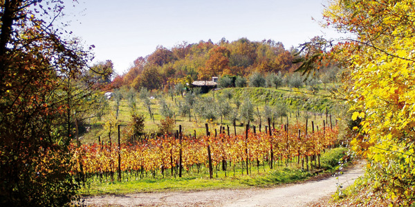
Halfway down the road you may decide to go down to Stremiz, following the first stretch of the Grivò stream, immersing a very picturesque environment, and refreshing especially on hot summer days.
Continuing on the path to Valle will lead to Pedrosa, m 754 a.s.l., you will then continue to Mount San Lorenzo, m 913 a.s.l., from which, descending through the “Church Meadows,” which offer a unique landscape, you will arrive at Valle, m 678 a.s.l. Our walk will continue to Costalunga, m 593 a.s.l., across the municipal road, then continuing along the path leading to Canal del Ferro, where it will end. This hike lasts between 7 and 9 hours, and to tackle it more comfortably it would be best to wear a pair of hiking shoes or if you prefer hiking boots.
THE WOODS OF THE COMMUNAI
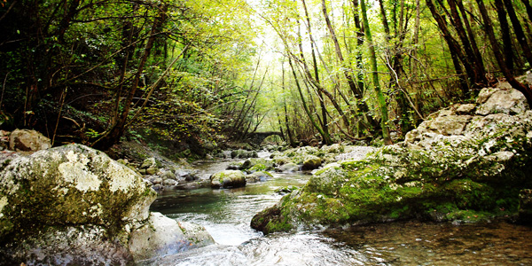
Also deserving of mention are the “Comunai,” located west of Faedis. These lands at the time of the Cucagna family belonged, as can be guessed, to the entire community: everyone could graze their animals, gather wood or forest fruits. This area is rich in vegetation and gives the opportunity to take some nice walks, surrounded by greenery and quiet.
To get to the “Commoners” you take Via Stentarie, to the right of City Hall, which will guide us along the entire area until we reach the village of Bellazoia (in the municipality of Povoletto). The “Commons” are crisscrossed by numerous trails and small roads that offer alternative routes.
You do not need any special equipment to tackle this walk, but if you want to go for the paths and lanes we recommend sportswear. The duration of the walks varies according to the choices you make. They can be half an hour as well as a few hours.